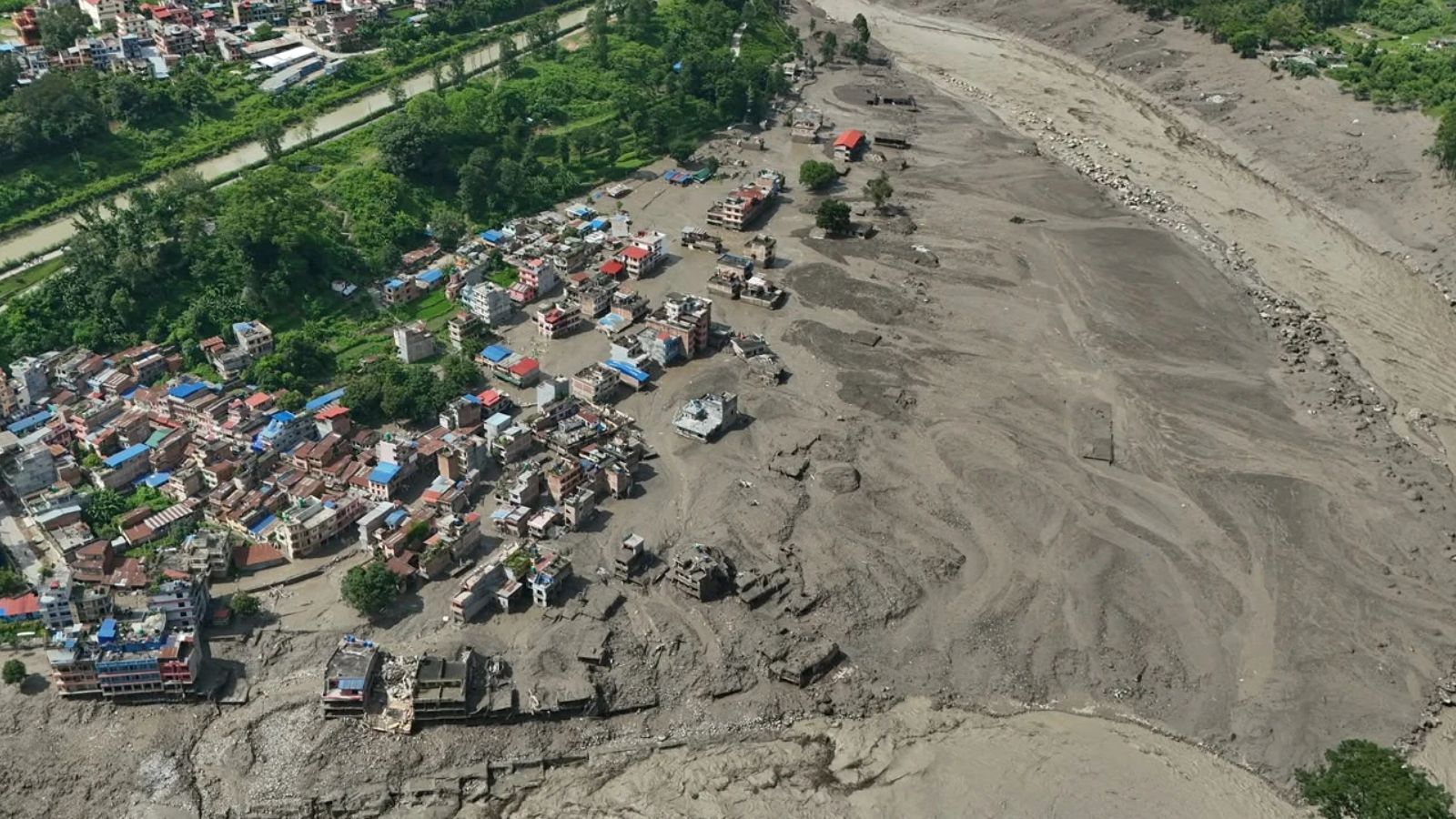
The catastrophic flash floods that decimated settlements along the Nepal-Tibet border stem from a complex cryo-hydrological failure mechanism rather than a simple weather anomaly. When a massive wall of mud, water, and debris surged down the Bhote Koshi and Trishuli river systems, destroying infrastructure and leaving hundreds dead or missing, public discourse immediately defaulted to broad attributions of global warming. This reactive framing obscures the actual physical processes at play. Deconstructing the disaster requires analyzing the structural mechanics of high-mountain destabilization, the operational constraints of cross-border emergency response, and the systemic vulnerabilities baked into Himalayan tourism and infrastructure corridors.
The Physical Mechanics of Cryo-Hydrological Failure
The event materialized not from standard monsoon rainfall, but from a high-altitude mass movement originating on the peaks near the border. Seismological data from the United States Geological Survey identified the initial ground motion as a magnitude 5.2 event driven by a massive rock-and-ice avalanche, correcting initial hypotheses that pointed solely to a tectonic earthquake or a standard glacial lake outburst flood.
The sequence of failure follows a rigorous physical pathway:
- Thermal Degradation of Permafrost: Long-term atmospheric warming in High Mountain Asia—which is heating at a rate faster than the global average—degrades interstitial permafrost. This frozen matrix acts as the structural cement holding steep bedrock and hanging glaciers together. As thermal energy penetrates deeper, shear strength declines exponentially.
- Structural Shear and Bedrock Collapse: High-resolution satellite imagery captured post-disaster reveals that a massive section of bedrock beneath the glacier gave way alongside the ice mass itself. The sheer weight of the destabilized material overcame the frictional resistance of the slope.
- Transient Damming and Hydrodynamic Surge: The cascading ice and rock debris slammed into the narrow Lhende River, creating a temporary, unstable natural dam. Water pooling behind this barrier rapidly accumulated volume until hydrostatic pressure exceeded the shear strength of the loose debris dam. The subsequent breach released a high-energy pulse capable of carrying enormous sediment loads downstream.
This cascade transforms potential energy stored at high elevations into kinetic destruction within minutes. The change in river color from green to thick brown slurry indicates a massive bedload transport of sediment, increasing the destructive density and momentum of the flood wave.
The Economic and Logistical Friction of Rescue Operations
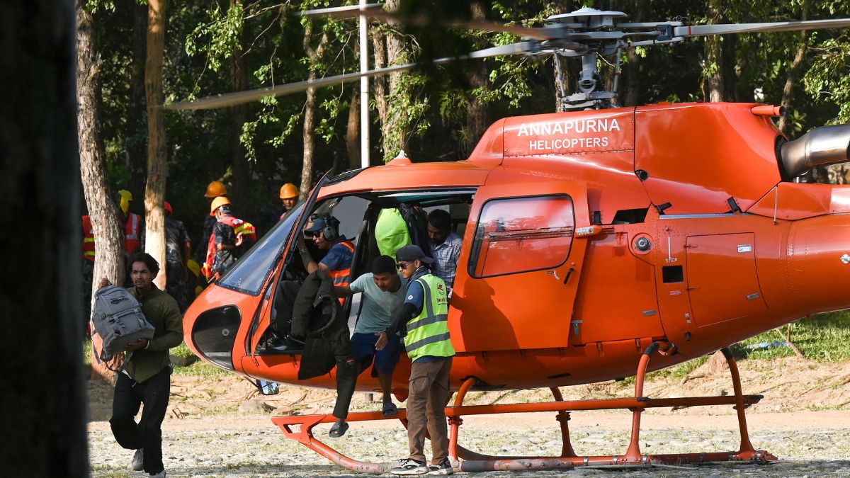
Search and recovery operations in the Rasuwa district and downstream zones face severe operational bottlenecks. Disaster response effectiveness is a function of logistical access, communication redundancy, and resource deployment speed. In this scenario, all three variables suffered immediate failure.
The destruction of approximately 40 kilometers of paved roads and dozens of suspension and motorable bridges severed ground transport networks instantly. Rotor-wing aircraft deployment—the primary vector for rapid extraction—was severely constrained by geographic barriers, localized microclimates, high-altitude performance limits, and dust-obscured landing zones in villages like Syapru Besi and Timure.
Furthermore, the demographic profile of the missing population highlights a severe informational asymmetry. Hundreds of those unaccounted for were transient travelers, including international pilgrims journeying toward Kailash Mansarovar and trekkers along high-altitude routes. Tour operators lacked real-time tracking telemetry, and localized mobile telecommunications networks collapsed concurrently with the initial impact. This created a multi-day data vacuum where command centers could not establish accurate manifests of who was in the impact zone versus who had successfully evacuated to higher ground.
Systemic Vulnerabilities in Transboundary River Basins
The severity of the impact underscores a systemic failure in transboundary risk management. The Himalayas do not respect geopolitical boundaries, yet early-warning telemetry and hydrological data sharing between upstream sovereign entities (such as China/Tibet) and downstream recipients (Nepal and India) operate with significant friction.
When an upstream retention barrier forms or an extreme melt event occurs, the time window for downstream warning is measured in minutes. Communities situated on alluvial fans and river terraces—chosen historically for trade routes and infrastructure placement like hydropower projects—sit directly within the hydraulic risk corridor. Traditional zoning laws frequently fail to account for low-frequency, high-magnitude cryo-hydrological events, treating historical flood lines as deterministic boundaries rather than probabilistic thresholds.
Mitigating future mass casualty events in high-mountain Asia requires a fundamental shift from post-disaster search operations to predictive infrastructural hardening. River basins characterized by rapid glacier retreat and supraglacial lake expansion demand automated, real-time acoustic and seismic sensors linked directly to automated downstream warning sirens. Infrastructure projects, including hydropower stations and trans-border highway corridors, must incorporate dynamic setback zones and engineering standards capable of withstanding high-density debris flows, replacing static historical baselines with forward-looking thermodynamic models of mountain destabilization.