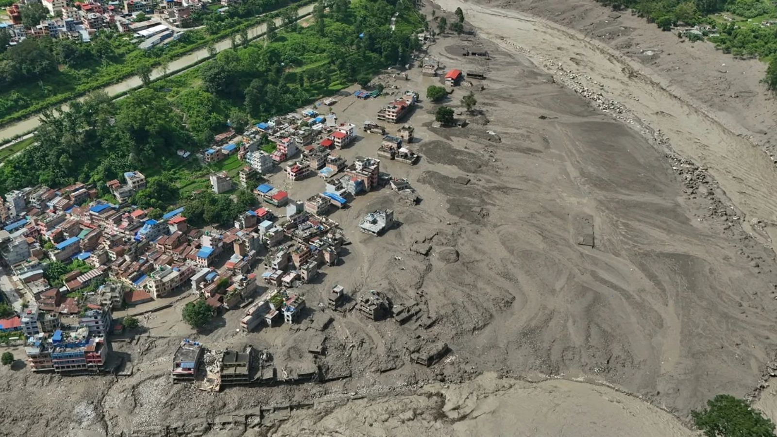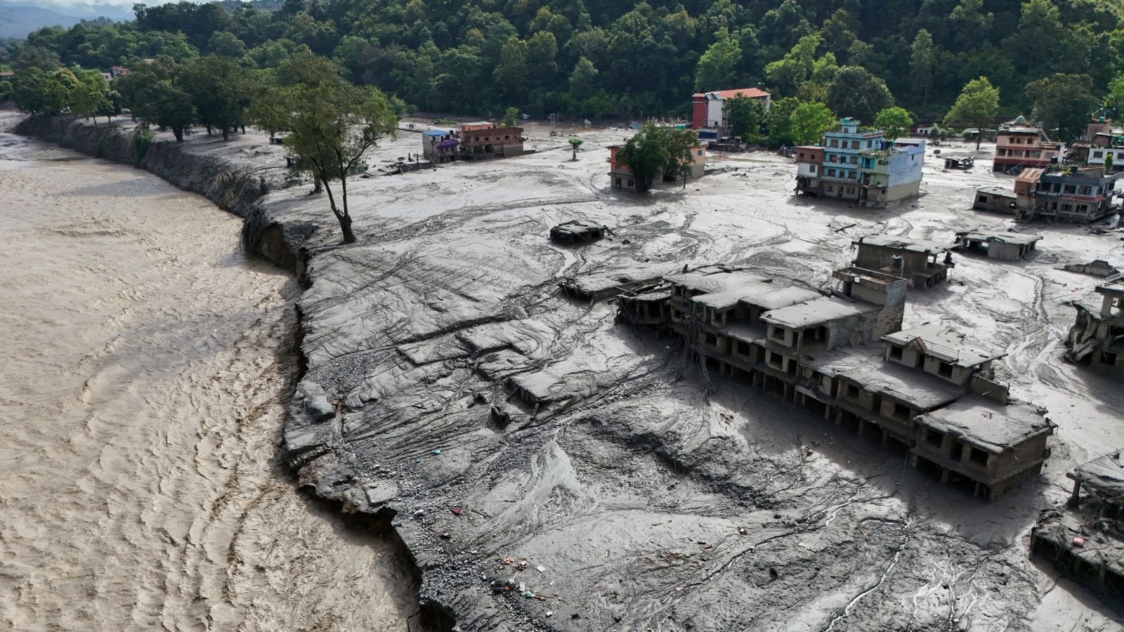
The convergence of high-altitude glacial mechanics and transboundary river corridors creates a distinct class of environmental hazard along the Nepal-China border. When an ice-rock avalanche or moraine failure occurs, the resulting hydrological shockwave does not merely elevate river levels; it fundamentally alters valley geometry through massive sediment bulking. Understanding this risk requires deconstructing the physical variables governing high-altitude hydraulic surges, moving past superficial weather narratives to evaluate the precise mechanics of glacial collapse, barrier lake formation, and downstream kinetic energy dissipation.
The Physical Mechanics of High-Altitude Hydrological Surges
Recent disasters along the Bhotekoshi and Trishuli river corridors underscore a recurring physical sequence: the rapid detachment of glacial mass at elevations exceeding 5,000 meters, followed by vertical descent and instantaneous valley damming. When a fractional component of a glacier breaks away—such as a 0.2 square kilometer ice mass dropping 1,200 vertical meters—the potential energy conversion is immense.
The kinetic energy of the falling mass pulverizes underlying rock and ice, generating a high-density debris flow. As this mixture enters narrow gorge systems, it acts as an ephemeral natural dam. Water pools rapidly behind the unstable barrier until hydrostatic pressure exceeds the shear strength of the blockage. The subsequent breach releases a flood wave characterized by extreme sediment concentration.
This process relies on three primary variables:
- Thermal Forcing: Ambient temperature spikes accelerate surface melt, lubricating the bedrock-ice interface and reducing frictional resistance.
- Volume Ratio: The proportion of solid ice and rock relative to liquid water dictates the density and destructive scouring capacity of the downstream surge.
- Constriction Geometry: Narrow, V-shaped Himalayan canyons restrict lateral dispersion, forcing the hydraulic head to climb vertically and maximize downstream momentum.
The Transboundary Threat Matrix of Secondary Barrier Lakes
When a primary surge subsides, it frequently leaves behind secondary hazards. Debris accumulation across tributary junctions creates unengineered barrier lakes that threaten immediate structural integrity. For instance, recent hydrological warnings issued by Chinese authorities indicate that barrier lakes holding millions of cubic meters of water near upper river confluences pose an imminent breach risk within a 72-hour window.
The hazard profile of these secondary impoundments differs fundamentally from stable reservoirs. Constructed from unconsolidated moraine material or chaotic avalanche debris, these natural dams lack spillways, control gates, or compacted cores. Inflow volumes from ongoing glacial melt quickly overtop the crest, inducing rapid piping erosion through the dam body. Once internal channels form within the loose sediment, total structural collapse occurs within minutes, sending a secondary flood pulse that compounds the devastation of the initial event.
Downstream Hydraulic Amplification and Infrastructure Vulnerability
As a glacial outburst or barrier breach travels down steep mountain gradients, the peak discharge does not simply attenuate; it often amplifies through bed and bank erosion. The moving slurry of boulders, mud, and water exerts extreme shear stress on river channels, scouring millions of tons of additional sediment into the flow.
Hydropower installations, surface transport networks, and human settlements situated within the floodplain face systemic vulnerabilities against this kinetic load. Traditional flood forecasting models that rely solely on rainfall accumulation metrics fail in these environments because the triggering mechanism is cryospheric rather than meteorological. River level spikes of up to nine meters within thirty minutes overwhelm standard telemetry and leave zero operational latency for manual evacuation protocols.
Strategic Mitigation and Monitoring Frameworks
Mitigating high-altitude flood risks requires shifting from reactive disaster response to predictive cryospheric engineering. Because visual observation of remote accumulation zones is impossible during cloud-cover periods common to monsoon seasons, continuous radar interferometry and satellite-based optical tracking must be paired with real-time seismic monitoring. Identifying micro-seismic signals associated with ice cracking allows automated systems to detect structural failures before mass displacement occurs.
Engineering interventions must prioritize the active drawdown of high-risk barrier lakes through controlled siphoning or strategic channel excavation before hydrostatic thresholds reach critical failure points. Furthermore, linear infrastructure along transboundary corridors—including international ports, bridges, and run-of-the-river hydroelectric plants—must incorporate elevated structural tolerances and mandatory setback zones based on maximum credible hydrodynamic discharge calculations rather than historical water marks.
Establish automated acoustic sensors and real-time pressure transducers along high-risk tributaries like the Lhende Khola to feed direct telemetry into a unified cross-border early-warning protocol, bypassing bureaucratic delays in downstream population centers.