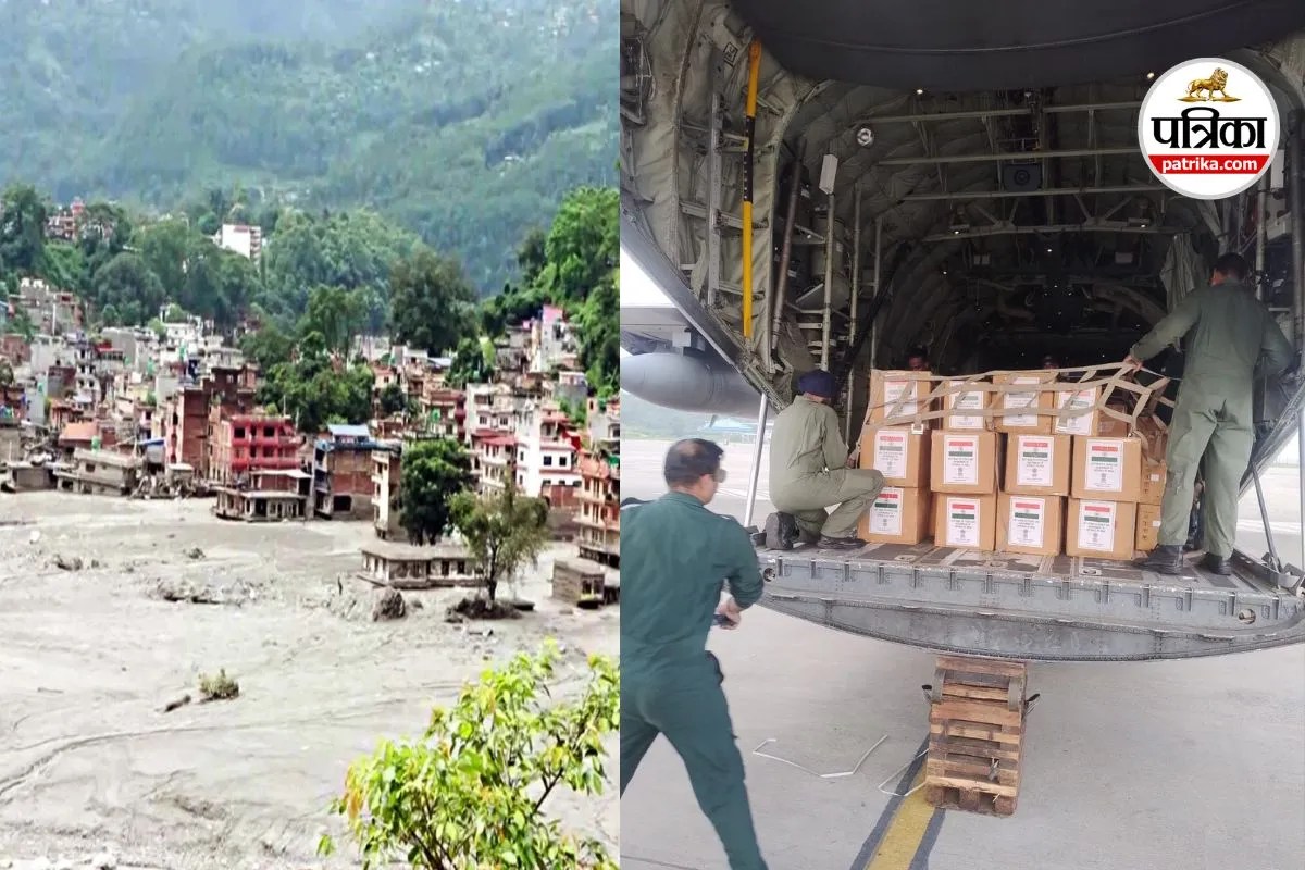
Catastrophic hydrological events in rugged topography systematically destroy ground transport infrastructure, forcing an immediate transition from terrestrial logistics to unconventional aerial intervention. When monsoonal flooding and glacial outbursts obliterate bridges, roads, and valley passages, traditional disaster recovery models break down entirely. Human rescue teams facing unstable mudslides, secondary rockfalls, and impassable torrents encounter severe operational friction. In these environments, unmanned aerial systems have transitioned from passive mapping tools to active nodes in emergency logistics chains, executing tasks ranging from heavy cargo delivery to remote human remains extraction.
The Operational Cost Function of Mountain Logistics
Deploying heavy assets like rotary-wing aircraft in Himalayan terrain involves prohibitive economic and physical constraints. Helicopters require substantial fuel logistics, clear landing zones, and favorable meteorological windows, all of which are routinely absent during active flash flood events. Conversely, heavy-lift unmanned aerial vehicles operate on decentralized logistics chains, requiring minimal footprint and zero surface preparation for launch and recovery.
The economic efficiency of unmanned transport relative to conventional aviation is dictated by payload-to-cost ratios per kilometer. While a utility helicopter incurs high hourly operational overhead, electric or hybrid heavy-lift drones lower the cost threshold for short-radius, high-risk sorties.
- Fixed Infrastructure Dependence: Helicopters depend on established airfields or designated landing pads, whereas unmanned platforms launch from arbitrary coordinates near operations.
- Personnel Risk Exposure: Manned flights place flight crews directly into high-turbulence, low-visibility mountain corridors. Unmanned systems externalize this risk entirely.
- Turnaround Velocity: Ground-controlled vertical takeoff and landing craft eliminate lengthy pre-flight diagnostic cycles required for complex turbine aircraft.
Mechanized Extraction and the Limit of Human Access
The deployment of drones to transport human remains from cut-off zones, such as the recent operations in the Nuwakot district of Nepal, highlights a structural shift in post-disaster triage. When ground teams cannot reach zones compromised by thick alluvial mud and unstable slope gradients, retrieval operations stall. Leaving remains behind creates epidemiological hazards and psychological distress for affected communities, while risking the lives of recovery personnel.
The mechanics of aerial body recovery require specialized rigging and precise weight distribution to maintain vehicle stability during flight. Unmanned platforms utilized in these contexts bridge the gap between complete operational abandonment and unsafe manual recovery.
[Disaster Zone: Roads Obstructed]
       │
       ├──> Traditional Ground Recovery: High Personnel Risk / Zero Access
       └──> Unmanned Aerial Extraction: Controlled Payload / Zero Personnel Risk
This capability redefines standard operating procedures in mass casualty events across mountainous regions. The primary bottleneck shifts from physical pathfinding to battery endurance, payload stabilization, and line-of-sight communication links obstructed by deep gorges.
Decentralized Assessment and Triage Architecture
Beyond cargo transport, disaster zones demand rapid intelligence gathering to allocate scarce medical and nutritional assets effectively. Standard ground-based assessments fail when settlements are isolated by washed-out suspension bridges. Integrating loudspeakers and high-resolution optical sensors onto low-altitude flight platforms creates an interactive triage loop.
Villagers in isolated pockets respond to standardized visual prompts queried by automated or remote-piloted craft. This mechanism bypasses telecommunication network failures caused by downed cellular towers and power grids.
- Visual Polling Protocols: Operators query stranded populations regarding water, medical, and food deficits using binary hand signals.
- In-Situ Data Logging: Ground requirements are translated into geographic coordinates or written identifiers captured by onboard cameras, feeding real-time inputs back to central logistics teams.
- Targeted Supply Drops: Verified deficits direct the immediate dispatch of automated payload runs, maximizing inventory efficiency and preventing resource misallocation.
Subsurface Exploration Constraints
Hydropower infrastructure situated along river corridors often becomes a secondary trap during catastrophic flooding, with tunnels filling with debris, slurry, and trapped workers. Human entry into flooded, structurally compromised penstocks or diversion tunnels presents unacceptable mortality risks.
Deploying specialized micro-aerial or tethered ground-aerial hybrid drones inside subterranean infrastructure allows operators to map internal hazards without risking rescue divers or engineering squads. However, these operations face severe technical barriers, including complete signal attenuation underground, absolute darkness, and turbulent water currents blocking internal chambers. The tactical value lies in rapid negative verification—confirming the absence of survivors prior to committing heavy engineering assets to dangerous clearance operations.
Scalability and Regulatory Integration
The maturation of domestic drone ecosystems in regions prone to natural hazards demonstrates how localized engineering talent replaces reliance on international aid response times. Local manufacturing and assembly lower maintenance costs and allow rapid hardware iteration based on immediate field feedback.
Scaling these systems requires the establishment of flexible regulatory frameworks that balance airspace safety with emergency exemptions. Bureaucratic delays in flight authorizations during active disaster phases directly increase mortality rates by slowing response velocities. Future resilience depends on pre-approved emergency corridors, automated air traffic separation for unmanned fleets, and standardized interoperability between military, police, and private technology providers.
Integrate localized manufacturing hubs with pre-positioned emergency drone fleets across high-risk river basins to reduce deployment latency to under two hours following primary impact.
For a visual look at how these technologies operate in the field, see this Nepal flood rescue coverage, which highlights the scale of destruction and the tactical deployment of aerial monitoring assets during the crisis.
http://googleusercontent.com/youtube_content/1