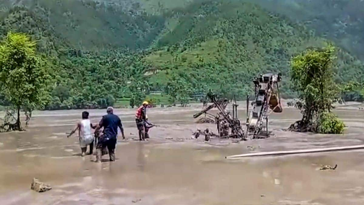
Mountains don't care about national borders. On the morning of August 26, 2026, that brutal reality hit the Himalayas with terrifying force. A massive chunk of rock and ice detached high above the Lhende valley near the Nepal-Tibet border, triggering a high-energy flash flood that roared down the Bhote Koshi and Trishuli river corridors. Within minutes, a wall of water, mud, and debris wiped out the Rasuwagadhi border complex, tore through hydropower projects, and shattered communities.
The numbers are staggering. Over fourteen hundred lives lost. Thousands still missing. Billions of dollars in structural damage. Yet, looking past the wreckage reveals deeper structural failures that led to this catastrophe. If you want true closure for the communities left behind, you have to look at what went wrong before the water started rising.
The Morning the Mountain Collapsed
Disasters of this scale don't happen in a vacuum. At roughly 8:37 AM on that late August morning, an ice-rock avalanche slammed into the Lhende Khola. The initial mass movement triggered cascading debris flows that gained momentum with every single kilometer.
The surge didn't just rise; it exploded down the valley. It smashed through Timure and Syabrubesi, carrying vehicles, concrete structures, and human lives toward Trishuli Bazaar and Devighat. Some bodies were swept nearly two hundred and forty kilometers downstream into the plains of Uttar Pradesh.
People living in these corridors didn't stand a chance. Warning sirens didn't sound because the trigger happened miles above conventional monitoring stations. When a mountain slope fails at that altitude, the reaction window isn't measured in hours. It's measured in seconds.
Why Traditional Warning Systems Failed Completely
You can't protect mountain communities with lowland tools. Traditional flood gauges placed along riverbanks in the plains are basically useless when a high-altitude glacial lake outburst or rock avalanche hits upstream. By the time the water hits the sensor, the disaster has already arrived.
The disaster exposed a glaring blind spot in transboundary cooperation. The upper riparian area sits across the border in Tibet, meaning critical data on slope stability, permafrost thaw, and glacial activity doesn't flow freely to downstream authorities in Nepal.
Real-time telemetry requires shared regional systems. Right now, information sharing between neighboring nations remains reactive and ad hoc. Governments exchange diplomatic notes after lives are lost, but they don't share seismic arrays, satellite tracking, or ice-mass data before a slope gives way. That bureaucratic lag costs lives. Until regional authorities set up a standing Himalayan early warning network with automated data sharing, valleys like the Bhote Koshi will remain sitting ducks.
The Devastating Toll on Infrastructure and Livelihoods
Water destroys more than houses. It erases economic lifelines. The flash flood hammered thirteen hydropower projects across the corridor, knocking nearly 780 megawatts of generating capacity off the grid while damaging plants still under construction.
Road networks vanished overnight. Forty-one bridges were washed away alongside miles of the Pasang Lhamu Highway, isolating remote mountain districts entirely. In a region dependent on trade and tourism, cutting off the all-weather road link to China choked local survival.
Healthcare took a direct hit too. The Syafrubesi Health Post was completely destroyed, and other local facilities lost power, medical supplies, and clean water. When basic infrastructure collapses simultaneously, survival turns into a desperate scramble. Families found their food and fuel stocks running dry within forty-eight hours. Clean water shortages threatened secondary health crises, proving that the immediate flood is only phase one of a multi-layered emergency.
Tracking the Missing and Healing the Invisible Scars
When mass disasters strike high-altitude transit and pilgrimage routes, accounting for everyone becomes an administrative nightmare. Hundreds of missing individuals included foreign tourists, seasonal laborers, and pilgrims waiting to cross toward Mount Kailash. Because casual travel registries didn't exist, families spent weeks agonizing in the dark, unsure if their loved ones were trapped or swept away.
Simple digital travel registration systems could change that. A lightweight, privacy-respecting check-in linked to mobile numbers would let authorities know who is actually inside a high-risk corridor when disaster hits.
Beyond physical tracking lies the invisible trauma. Thousands of survivors faced severe psychological stress, anxiety, and post-traumatic stress disorder as rescue teams pulled bodies from the mud. Emergency mental health and psychosocial support programs had to scramble to reach thousands of distressed residents. You can't just rebuild concrete walls and ignore the fractured minds of a community that watched their entire world wash away.
The Grim Realities of Disaster Recovery and Identification
Finding closure after a disaster like this isn't just about clearing mud or handing out relief checks. It's about recovering the dead and returning names to the missing. That process broke down under the weight of sheer scale.
Local mortuaries were completely overwhelmed. Bodies recovered from the riverbanks required facial photography, DNA profiling, and complex forensic tracking. In many cases, emergency responders had to use temporary burial sites because cremation traditions couldn't be accommodated amid the chaos. That friction caused deep public distress.
Forensic capacity cannot be improvised on the fly. Mass-fatality management requires pre-positioned mobile refrigeration units, standing disaster victim identification protocols, and trained local personnel who know how to handle multi-district recovery. When hundreds of workers remain missing in collapsed tunneling projects or washed-away camps, families deserve rigorous, compassionate tracking rather than administrative silence.
Rebuilding Smarter Instead of Repeating Past Mistakes
Reconstruction plans often fall into a dangerous trap. Governments rush to rebuild roads, bridges, and power plants exactly where they stood before, setting themselves up for the next inevitable strike.
The Himalayan risk environment has fundamentally changed. Climate pressures, warming permafrost, and unpredictable extreme weather mean historical rainfall and hazard data are no longer reliable baselines. Engineering standards must adapt to multi-hazard cascades. That means moving vulnerable structures out of high-risk debris corridors, enforcing strict zoning laws, and integrating geo-mechanical slope stability models into every single infrastructure project.
Funding this transformation is another hurdle. Prime Minister Balendra Shah and other leaders have pushed international platforms for climate justice and accessible grant-based financing, pointing out that developing nations bear the brunt of environmental volatility caused by global emissions. Communities cannot rebuild complex regional infrastructure using empty promises or delayed aid packages.
The closure people want won't come from apologies or temporary relief payouts. It comes from structural changes that ensure the next generation doesn't watch their homes wash away in the middle of a Tuesday morning. Stop treating these events as unpredictable flukes. They are predictable hazards waiting for institutional accountability.