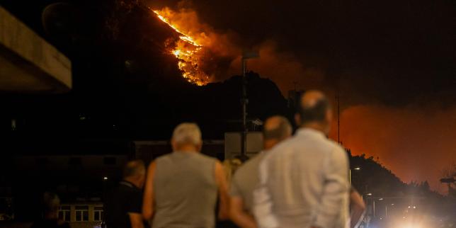
Crisis response systems fail at the intersection of acute environmental volatility and systemic institutional inertia. When extreme wildfire events strike high-density tourism corridors like the Croatian Adriatic coast, the resulting operational breakdown is rarely just a failure of containment; it is a failure of resource allocation, predictive modeling, and demand-capacity matching.
A comprehensive examination of the recent emergency event involving over 2,000 evacuations, structural casualties, and widespread territorial alert status reveals distinct structural vulnerabilities. Managing regional catastrophe requires moving beyond reactive suppression toward predictive infrastructure optimization, logistical hardening, and behavioral compliance management.
The Operational Anatomy of Coastal Wildfire Propagation
Wildfire acceleration along the Adriatic littoral is governed by a strict set of topographic and meteorological inputs. The interaction between dry maritime winds, complex karst topography, and high fuel loads creates a highly predictable vector for rapid flame spread. Yet, emergency management frameworks frequently treat these variables as stochastic anomalies rather than quantifiable parameters.
[Dry Maritime Winds] + [Karst Topography Fuel Load]
       │
       ▼
[Rapid Flame Vector Acceleration]
       │
       ▼
[Systemic Evacuation Bottleneck]
The primary driver of severe outcomes in this geography is the temporal compression of the threat lifecycle. Urban density meets volatile brushland along a narrow coastal strip constrained by mountainous terrain. When a ignition event occurs, the time window between initial detection and structural compromise is measured in minutes, not hours.
The Vector Variables
- Topographic Venting: Steep elevation gradients accelerate convective heat transfer, pushing fires uphill faster than traditional ground crews can reposition.
- Wind-Driven Embers: High-velocity coastal gusts carry incandescent material across natural firebreaks, transforming linear containment lines into multi-point spot fires.
- Fuel Continuity: Unmanaged Mediterranean macchia and pine forests provide continuous fuel beds that burn at high intensities, overwhelming standard suppression tactics.
Quantifying the Logistics Deficit
Evacuating thousands of residents and transient populations from a linear coastal geography exposes a severe structural limitation in local transportation networks. Coastal regions characterized by single-axis transit corridors suffer from immediate capacity saturation during emergency egress events.
Evacuation Demand = (Local Population + Tourist Density)
Transportation Capacity = Single-Axis Coastal Highway
Result = Immediate Structural Gridlock
During the recent crisis, the movement of more than 2,000 individuals highlighted the friction inherent in mixing panic-driven private vehicular traffic with emergency response logistics. When ingress and egress share the same coastal artery, suppression assets, medical units, and evacuees compete for identical spatial resources.
The Logistics Failure Points
- Single-Point Dependency: Reliance on coastal main roads creates an absolute bottleneck when evacuation orders are issued simultaneously across multiple zones.
- Asset Mobilization Latency: Aerial suppression units face deployment delays due to high wind conditions common during peak fire weather, rendering primary technological solutions temporarily inert.
- Communication Fragmentation: Real-time data sharing between meteorological agencies, local civil protection units, and municipal authorities often operates on siloed communication channels, delaying tactical execution.
Economic and Structural Vulnerability
The cost function of coastal wildfires extends far beyond immediate suppression expenditures. The economic exposure of the Adriatic region is heavily concentrated in the hospitality and tourism sectors, creating a dual crisis of physical safety and asset devaluation.
When a state of alert is declared, the downstream economic impact reverberates through cancellation cascades, infrastructure damage, and brand erosion. Traditional risk assessment models often miscalculate these losses by focusing solely on physical timber or structural assets while ignoring the velocity of revenue interruption.
The True Cost Matrix
- Direct Asset Loss: Residential and commercial structures destroyed by radiant heat and direct flame contact.
- Operational Interruption: Complete cessation of regional tourism commerce during peak operational windows.
- Reputational Discounting: Long-term behavioral shifts among travelers who reallocate destination preference based on perceived safety metrics.
Strategic Reform Framework for High-Risk Littoral Zones
Mitigating future catastrophic failures requires an operational pivot from reactive emergency management to preventive systems design. Jurisdictions facing similar environmental threats must implement structural changes across three distinct operational layers.
1. Hardening Infrastructure and Egress
Municipalities must eliminate single-point transit dependencies by engineering secondary evacuation routes that bypass primary coastal arteries. Furthermore, strict urban-wildland interface building codes must mandate non-combustible roofing materials, defensible spatial buffers, and underground utility integration to prevent secondary ignition sources during high-wind events.
2. Decentralizing Emergency Command
Centralized command structures frequently experience latency when processing localized environmental data. Empowering hyper-local response nodes equipped with autonomous drone surveillance, pre-positioned water reservoirs, and localized satellite communication links eliminates command delays.
3. Automated Behavioral Compliance
Relying on voluntary compliance or fragmented broadcast messaging during rapid-onset evacuations introduces fatal delays. Implementing geofenced emergency alert protocols that automatically push mandatory routing instructions directly to all mobile devices within a designated threat polygon removes cognitive friction from the evacuation process.
Execute a comprehensive stress test of regional transit bottlenecks under maximum simulated tourist density, reallocate civil protection budgets from post-event suppression to pre-event fuel reduction along critical topographic corridors, and mandate real-time interoperability protocols for all multi-agency communications.