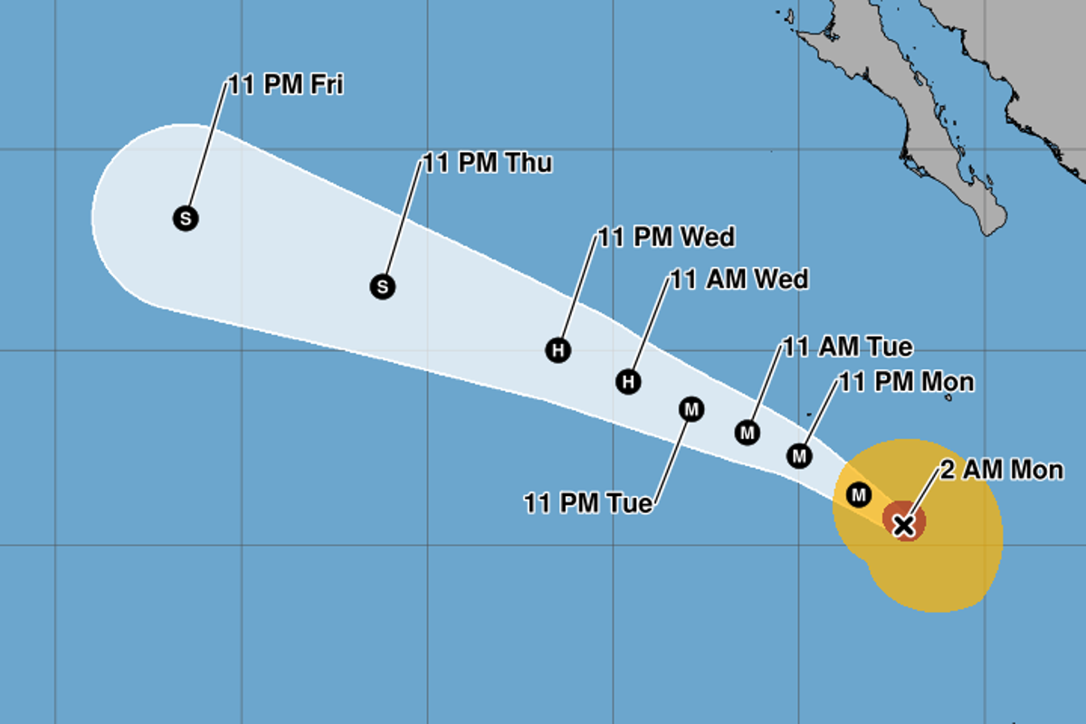
Every single time a storm crosses an arbitrary wind-speed threshold, the media loses its collective mind. Headlines scream about monster tempests, historic threats, and unprecedented fury. Genevieve recently punched up to a Category 5 in the East Pacific, and the internet instantly flooded with apocalyptic panic. Meteorologists hyperventilate on television, politicians dust off evacuation playbooks, and the public treats the designation like a death warrant descending from the stratosphere.
It is time to stop buying into the weather industrial complex's favorite marketing trick.
The Saffir-Simpson Hurricane Wind Scale is a relic of 1970s engineering that measures one thing and one thing only: peak sustained surface wind speed. It does not measure rainfall. It does not measure storm surge geography. It does not account for the forward speed of the system or the sheer geographic footprint of the vortex. Yet, slap a "Category 5" label on a storm like Genevieve, and the entire meteorological establishment treats wind velocity as a proxy for total societal destruction.
I have spent years analyzing disaster economics and emergency response logistics. I have watched municipal governments burn tens of millions of dollars evacuating the wrong zones because a storm hit a magical number on a flawed chart, while actual lethal hazards like inland flooding went completely ignored by panicked citizens fixated on wind tags.
We are measuring the wrong metric, reacting to the wrong threat, and scaring people for clicks.
The Flawed Physics of the Saffir-Simpson Scale
Let us look at how the sausage is made. Developed in 1971 by consulting engineer Herbert Saffir and meteorologist Robert Simpson, the scale was designed to give structural engineers a quick way to estimate potential building damage based on wind speeds.
That is it. It was never built as a comprehensive human danger index.
A Category 5 storm requires sustained winds exceeding 157 miles per hour. When Genevieve crossed that line in the open waters of the East Pacific, automated weather stations and reconnaissance flights lit up. Twitter panicked. Cable news anchors stood in parking lots pretending to be blown over.
Here is what nobody on television wants to admit: wind speed is a terrible indicator of total destruction.
Imagine a scenario where a hyper-compact, intense tropical cyclone spins up a tiny core of Category 5 winds over an uninhabited patch of ocean or a tiny, well-engineered atoll. Buildings built to modern codes shrug it off. Meanwhile, a sluggish, disorganized Tropical Storm or Category 1 system stalls over a mountainous coast, dumps forty inches of rain, triggers massive landslides, and wipes out entire communities.
Which storm is worse? If you ask the Saffir-Simpson scale, the Category 5 monster wins every time. If you ask a mortician or an insurance actuary, the slow-draining rainmaker is an order of magnitude more lethal and destructive.
By hyper-focusing public attention on wind scale categories, we create a cognitive bias. People board up their windows against a Category 5 wind threat, think they are safe because their house is reinforced concrete, and then drown in three feet of storm surge or flash floods because nobody warned them about water volume. Wind kills fewer people in modern hurricanes than water by a factor of nearly nine to one.
Why the East Pacific Obsession Misses the Real Danger
The East Pacific basin is a fascinating meteorological laboratory, but the obsession with records there reveals a deep misunderstanding of global risk dynamics. When a storm like Genevieve goes nuclear out over the warm waters off the Mexican coast, it makes for great satellite imagery.
Most East Pacific hurricanes share a common fate: they track northwest into cooler waters and cold currents, or they curl back toward the Mexican coastline as weakening remnants, dumping heavy moisture. They rarely pose a direct, high-velocity wind threat to major population centers compared to their Atlantic counterparts, which bullseye the Gulf Coast and the Caribbean.
Yet, every time an East Pacific storm achieves top-tier status, atmospheric scientists act like humanity has just witnessed a lunar landing.
This is where the expertise gets warped by institutional self-preservation. National meteorological agencies rely on public visibility and perceived danger to secure funding budgets. If every storm is a historic beast, the public stays on edge, and the funding spigots stay wide open. But treating a storm in the middle of nowhere as an existential crisis degrades public trust.
When you cry wolf over wind speeds every time a hurricane strengthens over deep water, people stop evacuating when a real, water-driven catastrophe approaches their zip code.
The Cost of Bad Data
Let us talk about the economic carnage of our obsession with wind categories.
When a storm hits Category 5 status, emergency management protocols shift into overdrive. Mandatory evacuations are triggered across massive coastal radii. Traffic jams gridlock highways. Hospitals spend fortunes on emergency generator fuel and patient transfers. Businesses shut down for days.
Billions of dollars evaporate in economic activity based on a wind threshold that often dissipates before landfall.
I have seen municipal emergency plans that treat a Category 3 hurricane as an annoyance and a Category 5 as the apocalypse, regardless of where the storm is actually tracking or what hazards it carries. This binary panic ignores local bathymetry, tide cycles, and atmospheric moisture content—the actual variables that dictate whether a coastal community survives a tropical system intact.
The National Hurricane Center has tried over the years to pivot toward a more holistic hazard-based warning system, pushing storm surge watches and inland flood graphics. But the media and the public refuse to let go of the category number. The number is sexy. The number fits on a graphic. The number makes for a great viral tweet.
What We Should Be Measuring Instead
If we wanted an honest, functional way to measure tropical cyclone threat, we would scrap the Saffir-Simpson wind scale entirely.
We would replace it with an integrated damage potential index that factors in:
- Integrated Kinetic Energy (IKE), which measures the actual mass of moving air and the size of the storm, not just peak velocity at a single point.
- Rainfall accumulation potential, calculated via precipitable water vapor and storm forward speed.
- Localized storm surge vulnerability, weighted by coastal topography and astronomical tide schedules.
Under a modern metric, a massive, sprawling Category 3 storm with a huge wind field and torrential rains would score higher on the danger index than a tiny, razor-sharp Category 5 pinhole hurricane spinning harmlessly offshore.
Genevieve was a magnificent display of atmospheric thermodynamics. The warm sea surface temperatures and low vertical wind shear did exactly what physics dictates they should do: spin up a tight, ferocious vortex.
It was a triumph of nature's engine, but it was not a human catastrophe.
Stop letting a 1970s engineering scale dictate how you assess risk. The next time a headline screams about a Category 5 storm shattering records in the Pacific or anywhere else, look past the wind speed. Check the water. Check the track. Check the size.
The wind is just noise. The water is what drowns you.


