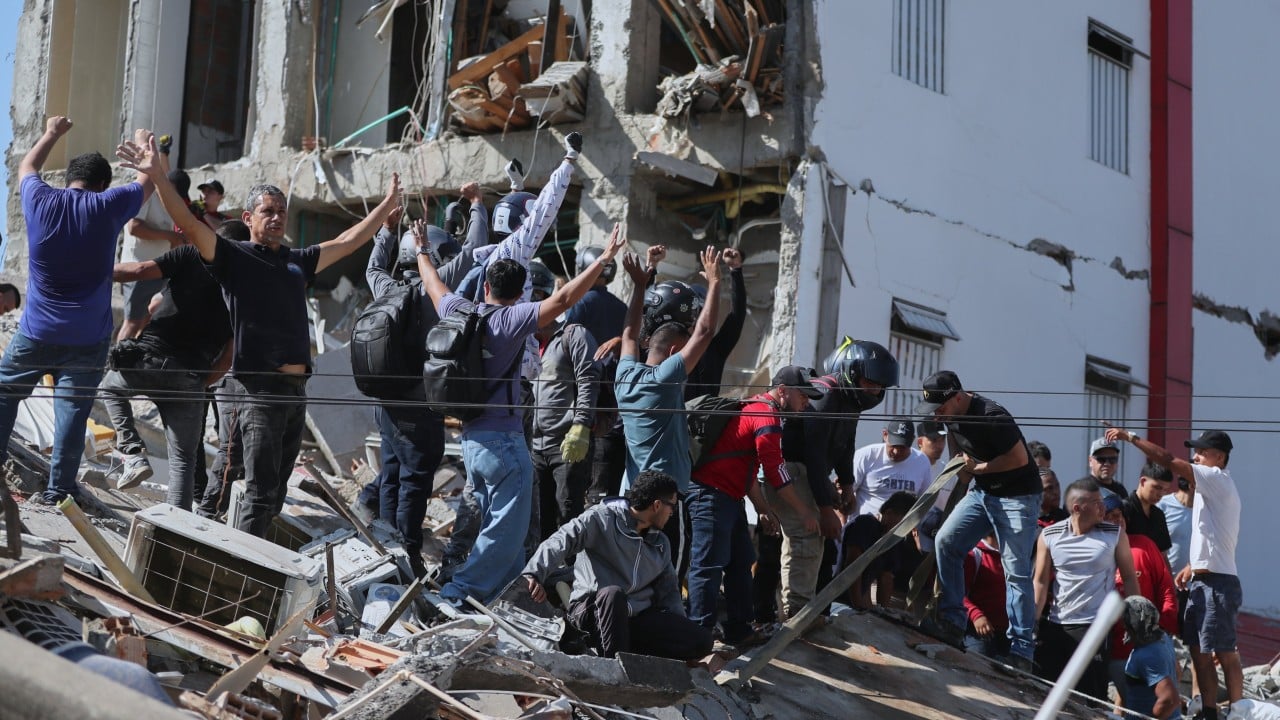
A magnitude 7.4 earthquake struck western Colombia near the municipality of San José del Palmar in the Chocó region, producing significant structural damage and fatalities across multiple urban centers. Unlike surface-level ruptures that release energy instantaneously into immediate crustal layers, this seismic event originated at an intermediate depth of approximately 107 kilometers. Evaluating the impact requires moving past simple casualty aggregates to analyze the mechanical interaction between hypocentral depth, wave propagation attenuation, and regional building typology.
The Mechanics of Intermediate Depth Seismicity
Seismic energy dissipation is directly governed by hypocentral depth. Deep-focus and intermediate-focus earthquakes, such as this event originating over 100 kilometers underground, spread wave propagation across a wider geographic footprint while dampening the hyper-localized peak ground acceleration typically seen in shallow crustal faults. If you enjoyed this article, you should check out: this related article.
- Energy Dispersion: The upward-traveling body waves (both P-waves and S-waves) traversed dense lithospheric mantles before hitting the heterogeneous upper crust of the Andean cordillera.
- Frequency Modulation: High-frequency waves, which severely penalize unreinforced masonry and low-rise brittle structures, largely attenuated over the 107-kilometer transit.
- Extended Felt Area: Lower attenuation of mid-frequency waves explains why populations in Bogotá and regional sectors hundreds of kilometers away experienced pronounced horizontal swaying and evacuation alarms without catastrophic structural failure at the center of the capital.
The physical mechanism accounts for the dual reality of the disaster: widespread panic and moderate structural cracking across broad zones, contrasted with extreme, localized building collapses in specific urban corridors like Cali, Pereira, and Quibdó.
Urban Vulnerability Variables and Structural Collapse
The distribution of fatalities and building failures highlights structural vulnerability variances across western Colombia. The Chocó department, where the epicenter was registered, represents a high-risk zone characterized by limited municipal capital expenditure on seismic retrofitting and high concentrations of vernacular, unengineered construction. For another perspective on this development, check out the latest coverage from USA Today.
[Deep Subsurface Rupture (107 km)]
       │
       ▼
[Broad Energy Dispersion Across Andean Crust]
       │
       ├──► [High-Density Urban Centers (Cali/Pereira): Resonance in Mid-Rise Non-Ductile Concrete] ──► Structural Collapse
       │
       └──► [Rural Depleted Zones (Chocó): Unengineered Masonry Failure & Logistics Isolation] ──► Rescue Bottlenecks
Urban centers featuring mid-rise non-ductile concrete frames and unreinforced brick masonry absorbed the brunt of the kinetic transfer. In Cali and Pereira, structural failures concentrated in buildings lacking shear walls or adequate lateral force-resisting systems. When seismic waves matched the natural period of these intermediate-height structures, inter-story drift ratios exceeded material ductility thresholds, resulting in pancake collapses that trapped occupants.
Infrastructure Bottlenecks and Emergency Logistics
Emergency response efficacy during a multi-region seismic event is bounded by topographical and logistical constraints. The geography of western Colombia, defined by the rugged terrain of the Andean cordillera and the dense jungles of the Chocó province, creates immediate operational bottlenecks.
- Transport Isolation: Large portions of the epicentral zone rely heavily on riverine transport or localized air strips rather than redundant highway networks.
- Aviation Disruptions: Civil aviation authorities confirmed that structural assessments forced the suspension of operations at multiple regional airports, including those serving Pereira, Manizales, and Quibdó, temporarily halting the influx of rapid-response medical teams.
- Communication Degradation: Secondary infrastructure failures, including power grid interruptions and localized cellular tower damage, impaired damage assessment loops during the initial operational window.
Command structures face an optimization problem: dispatching heavy search-and-rescue assets across fractured mountain corridors while simultaneously managing secondary threats such as structural aftershocks and slope instability in saturated soils.
Resource Allocation and Operational Sequencing
Immediate post-disaster execution requires strict sequencing to minimize secondary mortality. Incident commanders must prioritize asset deployment using a triage matrix based on structural survival curves rather than political visibility.
- Structural Triage: Establish rapid reconnaissance teams to clear undamaged or lightly damaged lifelines (hospitals, water treatment facilities) to maintain baseline societal function.
- Heavy Extrication Deployment: Concentrate hydraulic shoring, acoustic sensors, and canine units exclusively on confirmed pancake collapses in high-density nodes such as Cali and Pereira where live-extraction probability remains mathematically viable within the 72-hour window.
- Logistical Redundancy Routing: Bypass compromised regional airports by establishing temporary staging bases in unaffected secondary cities with open highway links, bridging supplies via tactical ground transport into isolated Chocó sectors.
Resource deployment must remain fluid, accounting for localized aftershocks that can destabilize already compromised load-bearing elements.