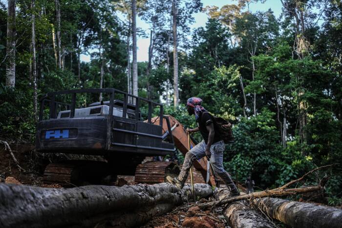
Maps do not stop chainsaws. GPS pins do not block excavators. And a shiny digital database full of sacred hunting grounds will not make a logging boss or gold dredge operator suddenly find Jesus.
Every few years, a feel-good story rolls out of conservation circles praising Indigenous communities for turning to GIS software, drones, and community mapping to defend their territory. Suriname’s Saamaka people—descendants of Maroons who escaped enslavement and built deep, sovereign life along the Upper Suriname River—frequently show up in those narratives as proof that tech-enabled documentation equals protection. You might also find this connected article insightful: Australia Is Not Turning Into America and Trying to Defuse the Anger Will Actually Cause the Explosion.
That is the lazy consensus. It sounds noble. It looks great in grant decks. It gives outsiders a comforting story where better cartography solves centuries of contested jurisdiction, extractive economics, and weak state enforcement.
It is also dangerously incomplete. As highlighted in recent articles by Associated Press, the effects are widespread.
A map is a mirror, not a shield. If you hand a community a map without legal teeth, enforcement muscle, and economic leverage, all you have really done is draw a neat shopping list for people looking for timber, gold, or concession land.
The Cartography Illusion
Let’s get the mechanics straight first. Community mapping—often called participatory mapping or counter-mapping—is the process where local residents record spatial data about their own land: ancestral villages, burial sites, farming plots, medicinal plant patches, fishing rapids, and historical boundaries.
Done well, it captures real spatial memory that official government maps routinely erase. Official maps are often drawn from desk assumptions, outdated survey lines, or timber and mining concessions handed out without real consultation.
Here is where the sloppy thinking starts. People treat visibility as security. They assume that once a sacred creek or traditional territory appears on a map or inside a geospatial file, predators will back off and courts will magically enforce it.
I have watched conservation and development initiatives burn through serious money on high-resolution mapping tools, tablets, and training workshops while the actual forest outside the village kept getting chewed up piece by piece. Software does not patrol a river at two in the morning. A polygon on a screen does not fine an illegal dredger or seize a heavy truck.
When the Saamaka or any other forest community maps its territory, they are doing something vital for internal clarity and public advocacy. Nobody serious denies that knowing your own terrain in structured spatial terms helps when arguing before courts or international bodies.
Still, confusing documentation with defense is a rookie mistake. A map tells you what is there and who claims it. It does not answer the only question that decides whether trees stay standing: Who has the power to stop someone from cutting them down?
Why "Who Owns the Forest?" Is the Wrong Question
Search any conservation feed and you will see the same framing repeated like a prayer: How can Indigenous peoples use mapping to protect their land? Or Why is documenting ancestral land key to saving the Amazon?
Those questions start from a broken premise. They treat information scarcity as the main bottleneck.
In Suriname, the friction over forest land has never been a simple case of nobody knowing where the Saamaka live. The Saamaka have lived in the interior for generations, fighting for autonomy long before modern satellites existed. The real clash sits inside overlapping claims, state concession regimes, informal and formal mining pressures, and the gap between constitutional or international principles and what happens on the ground.
Even the geography framing deserves a sharper look. Popular coverage routinely lumps everything south of the Guianas into "the Amazon" as shorthand for tropical forest drama. Geographically, Suriname sits in the Guiana Shield—a distinct, ancient geological region with its own ecology, watersheds, and political dynamics connected to the broader Amazonian biome, not a single uniform block managed from one office. Calling everything "the Amazon" blurs local governance realities before the reader even finishes the headline.
When outsiders ask how mapping protects the forest, they usually want a neat technical fix. They want a tool they can fund, photograph, and report on in an annual impact summary.
Ask the harder question instead: What happens the day after the map is finished?
Once the boundaries are drawn and the stories are logged, who enforces them? Who pays for monitoring patrols when fuel is expensive and distances are brutal? What happens when a local actor—or an outsider offering quick cash from small-scale gold or timber—tests the line?
If there is no credible consequence for crossing the line, the line is just ink and pixels.
The Real Mechanics of Land Defense
Protecting a tropical forest is an enforcement and governance problem wrapped inside an economic problem. Mapping is only step one of a much tougher sequence, and skipping ahead is how well-meaning projects fail.
1. Legitimacy vs. Legal Recognition
A community can have total internal consensus on where its lands run and still face a legal system that treats state concessions or incomplete title frameworks as superior. Documentation strengthens an argument, especially in regional human rights forums or domestic court battles, yet legal recognition takes years of grinding institutional work. A map does not automatically rewrite statutes.
2. Surveillance Without Response Is Theater
Recording a clearing on a GPS device or flying a drone over a damaged riverbank creates evidence. Evidence only matters if someone with authority—or collective community leverage—acts on it before the damage spreads. If reporting an encroachment leads to months of silence from authorities, people get discouraged and stop logging incidents.
3. The Cash Temptation Nobody Likes to Talk About
Remote forest economies are tough. Cash is scarce, transport is slow, and outside money from gold, timber, or quick deals looks very different from slow, conditional grant cycles. A map cannot compete with immediate household survival unless alternative livelihoods or community governance rules are strong enough to hold the line when temptation walks up the landing.
4. Data Ownership and Exposure
Any time sensitive spatial data is collected, there is a second-order risk: who holds the files, who can see them, and how they get used? Publishing exact locations of rare resources, sacred sites, or vulnerable zones without strict data governance can backfire if bad actors get hold of the same coordinates.
What Heavy Hitters and History Actually Show
Look at the broader scholarship on land tenure and forest protection, and a clear pattern emerges. Researchers like Elinor Ostrom showed decades ago that common-pool resources survive when local rules have clear boundaries, effective monitoring, graduated sanctions, and recognition by higher authorities—not when outsiders parachute in a single technical gadget.
In tropical forest governance more broadly, studies comparing titled or strongly recognized Indigenous and community lands against un-protected or contested areas repeatedly point to the same takeaway: secure rights plus active local governance do heavy lifting that mapping alone cannot match.
Consider what happens when a project stops at cartography. Imagine a scenario where an NGO funds a sleek digital mapping drive in a river community, trains youth to collect waypoints, and publishes an interactive story map. Six months later, the grant ends. The batteries die, nobody has budget for boat fuel to verify alerts, and an unauthorized operator moves in anyway. The map still exists on a server somewhere, looking impressive, while the canopy shrinks.
That is not a failure of the community. That is a failure of a strategy that mistook documentation for power.
The Uncomfortable Trade-Offs of Going Hard on Enforcement
My contrarian push here is straightforward: stop treating community mapping as the main event, and treat it strictly as intelligence and leverage inside a broader power-and-enforcement strategy.
Yet I would be lying if I pretended that approach comes with zero downsides. Pushing harder on enforcement, legal confrontation, and economic alternatives brings real friction.
- Slow timelines: Legal battles and institutional reform move at a crawl compared to a quick mapping workshop. Funders impatient for fast metrics often hate slow governance work.
- Internal tension: Hard rules and strict boundary enforcement inside a community can create friction when different families or sub-groups weigh short-term income against long-term conservation.
- Escalation risk: Confronting entrenched extractive interests—especially illegal or semi-formal operations—can raise the stakes for local leaders and monitors if they lack backing and legal protection.
- Over-engineering: Trying to solve everything at once can stall practical progress if projects get bogged down in bureaucracy instead of supporting concrete community priorities.
Ignoring those trade-offs does not make them disappear. It just leaves communities holding the bag when things get messy.
How to Actually Make Documentation Count
If you care about keeping standing forest standing—and respecting the people who live there—stop clapping every time someone draws a better map. Do the unglamorous work that gives the map teeth.
- Pair every map with a legal and political strategy. Decide upfront who needs to see the data, what legal claim or negotiation it supports, and how it connects to enforceable rules rather than sitting in a report.
- Fund ongoing operations, not just shiny launches. Pay for the boring essentials: boat fuel, maintenance, communications, legal support, and local coordination—not just software licenses and launch events.
- Lock down data sovereignty. Make sure the community controls access, permissions, and storage so sensitive spatial knowledge serves their interests rather than exposing them.
- Back local governance when money tempts people. Support real economic options and clear community decision-making mechanisms so rules hold up under pressure, not just on paper.
A map is a starting gun, not a finish line. Until someone with real leverage is ready to enforce what that map says, the trees are still gambling on the goodwill of whoever shows up with a saw.