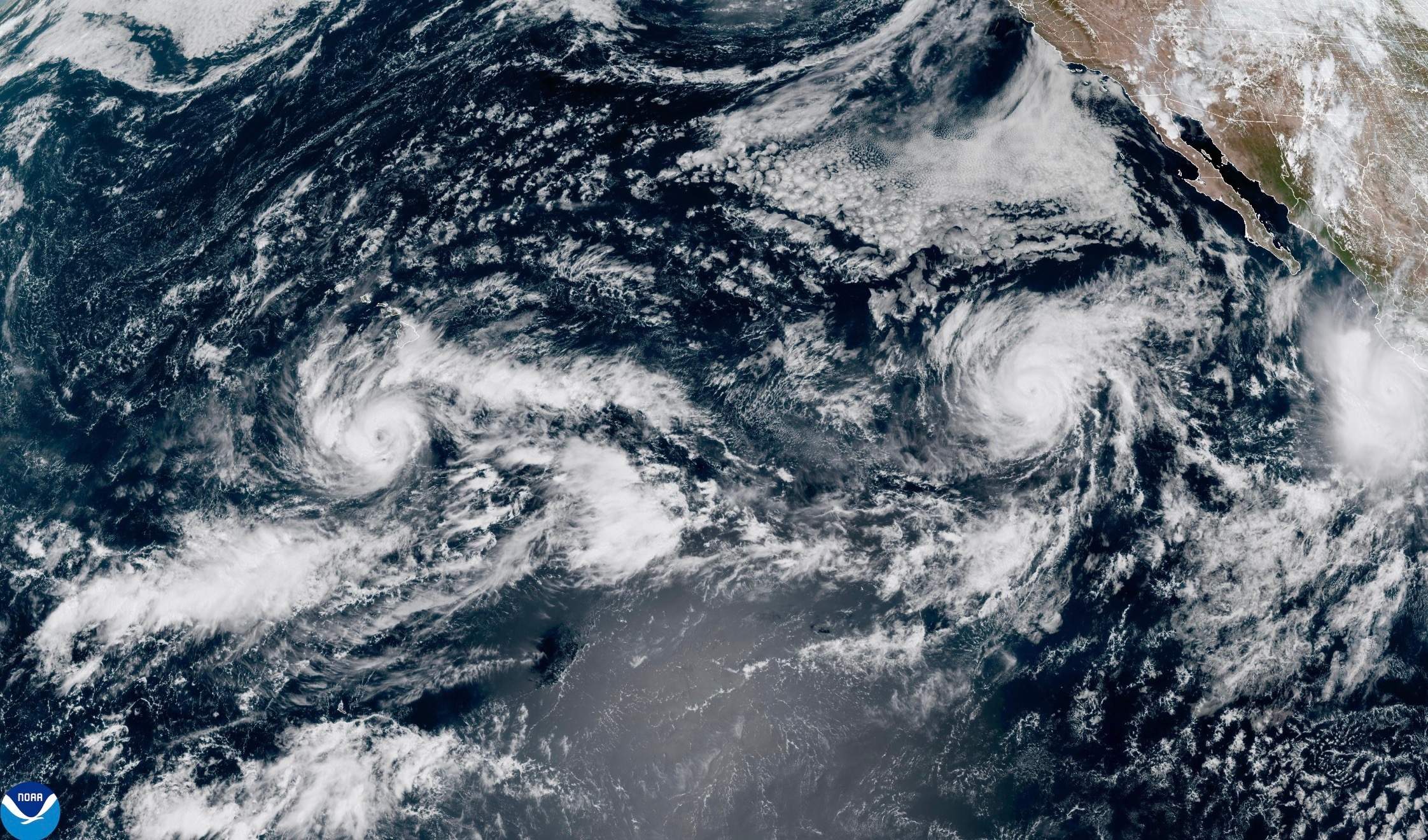
Analyzing tropical cyclone impacts along arid peninsular landscapes requires an explicit shift away from generalized storm narratives toward micro-topographic hydraulic assessments. When Hurricane Polo tracked toward the Baja California peninsula, the
Structural Mechanics of Extreme Hydrological Events In Arid Peninsulas
news, travel
When a tropical system encounters the topographic profile of the Baja California peninsula, the resulting meteorological interaction is rarely a simple precipitation event. It is a severe hydraulic stress test of regional infrastructure, municipal preparedness, and topographical drainage capacity. Evaluating threats like Hurricane Polo requires shifting focus away from atmospheric classifications and toward the physical vulnerability of the terrain and the economic architecture built upon it.
The Topographic Amplification Vector
Baja California features a spine of rugged mountain ranges, primarily the Sierra de la Giganta and the Sierra de San Francisco, flanked by narrow coastal plains. This topography creates a high-risk hydrological multiplier effect during heavy rainfall episodes.
When moisture-laden maritime air masses collide with steep elevation gradients, forced convective uplift occurs. The air cools rapidly, discharging massive volumes of water over compressed timeframes. Because the regional soils are predominantly arid, uncompacted, and structurally deficient in organic matter, their infiltration capacity is minimal. The ground acts almost entirely as an impermeable surface, converting rainfall directly into high-velocity runoff.
The kinetic energy of this runoff funnels immediately into dry riverbeds, locally known as arroyos. These channels, dry for the majority of the year, serve as primary drainage vectors. Urban expansion across the peninsula has frequently encroached upon these natural flow paths. When a high-volume system dumps months of average rainfall within hours, the arroyos experience rapid hydraulic loading, turning subterranean or dry depressions into destructive debris flows.
Infrastructure Vulnerability and the Drainage Deficit
The economic corridors of the southern and western portions of the peninsula rely on linear infrastructure—highways, coastal access roads, power transmission grids, and localized water treatment facilities. This architecture introduces systemic vulnerabilities when subjected to extreme weather.
Road networks often cross arroyos at grade or via culverts engineered for historical flood recurrence intervals that no longer reflect modern meteorological volatility. When peak discharge exceeds culvert capacity, water overtops the roadway, washing out sub-bases and isolating communities. The absence of redundant transportation corridors means that a single bridge failure completely fractures regional supply chains, halting the flow of food, fuel, and emergency medical services.
Power distribution infrastructure faces parallel failure modes. Wooden utility poles and shallow-anchored transmission towers situated in saturated alluvial soils lose structural integrity rapidly. Once soil cohesion fails under dynamic fluid loads, cascading grid failures follow, disabling municipal water pumping stations that depend on continuous electrical supply.
The Economic Cost Function of Reactive Disaster Management
Municipalities operating in high-exposure hazard zones face a distinct economic trade-off between pre-event capital allocation and post-event disaster recovery. Relying purely on emergency response creates an inefficient fiscal expenditure profile.
Emergency response incurs high transaction costs: rapid deployment of heavy machinery, emergency medical staging, temporary housing setup, and the loss of tourism-dependent economic output. Conversely, structural mitigation—such as retaining walls, expanded drainage channels, elevation of critical nodes, and strict zoning enforcement in arroyo buffers—requires high upfront capital investment with deferred returns.
The primary friction point in this model is political time-horizon bias. Infrastructure resilience projects yield returns measured in decades, whereas municipal budget cycles operate on compressed schedules, disincentivizing proactive engineering interventions in favor of reactive crisis management.
Operational Resilience Protocols
Mitigating life-threatening floods in topographically compressed regions requires a shift from predictive warning systems to hardening structural defenses.
Hydrological Mapping and Zoning Enforcement
Municipal planning departments must enforce strict setback requirements along all major arroyo networks. Mapping must integrate historical peak discharge data with climate-adjusted precipitation models to establish non-habitable buffer zones.
Redundant Lifeline Engineering
Critical infrastructure nodes—including hospitals, water treatment plants, and primary substations—must be evaluated for 100-year flood thresholds. Access routes to these facilities require structural hardening, including deep-piled foundations and multi-span bridges designed to withstand severe scour forces.
Decentralized Resource Staging
Because linear transportation links are inherently vulnerable to washout during major storm events, emergency supplies, fuel reserves, and heavy extraction equipment must be prepositioned within isolated municipal pockets rather than centralized distribution hubs.
Managing extreme hydrological events on arid peninsulas is an exercise in respecting topographical constraints. Ignoring the physical capacity of natural drainage channels guarantees that meteorological anomalies translate directly into systemic humanitarian and economic crises.